Sunday, August 11, 2019

Heading for Home/Trip Summary

After completing the Cassiar highway we made a fairly quick trip through the lower part of BC and across the US heading for Arizona.  We safely arrived home on Aug. 11 after 5 weeks on the road.  We had a great trip and experienced some wonderful scenery.  Our wildlife sightings were less this time than in previous years, but we did see and photograph a Yukon Wolf and a Red Fox which were very special.  In general, the weather was a little worst this time than on previous trips as we had numerous days with rain and high winds.  However, we had very little smoke from forest fires which was a nice change.

A few status from the trip:
Miles driven: 6167
Days on the road: 35
Nights in RV parks: 10
Nights in state/city/province/territory parks: 23
Nights boondocking: 1
Lowest gas price: $2.63/gal (Holbrook AZ)
Highest gas price: $5.84/gal (Dease Lake BC)
Gallons of fuel used:  677
Average miles/gal: 9.1
Cost per mile: $0.34

We knew we had some carrots that wouldn’t be allowed across the border so at a lunch stop we spotted some horses that were more than happy to take the carrots off our hands

Sunflower field in Montana


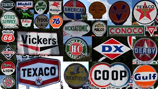
Near the campground that we stayed at in Provo UT someone had an amazing collection of old oil company signs.  Lots of familiar brands.

Now that we have left the Yukon and upper BC our wildlife photography subjects have definitely gotten much smaller.  But none the less nature is still amazing.


A male and female cross-bill near Jacob Lake in AZ

Trip Log:
Day 29 (117 miles) – Aug. 5, 2019 – To Kittle Falls WA

Day 30 (204 miles) – Aug. 6, 2019 – To Superior MT

Day 31 (147 miles) – Aug. 7, 2019 – To  Conner WA

Day 32 (289 miles) – Aug. 8, 2019 – To  Pocatello ID

Day 33 (289 miles) – Aug. 9, 2019 – To  Provo, UT

Day 34 (310 miles) – Aug. 10, 2019 – To  Jacob Lake, AZ

Day 35 (334 miles) – Aug. 11, 2019 – Chandler, AZ

Sunday, August 4, 2019

Cruising the Cassiar

There are two ways to get to Alaska from the lower-48.  The eastern route begins in Dawson Creek BC and basically follows the original road built by the US Army in 1942.  The western route follows the Cassiar highway which connects lower BC with the Alaska Highway near Watson Lake.  Since we were making a full loop, we took the eastern route up to Watson Lake and then followed the Cassiar highway back down. 

The Cassiar highway is very remote and challenging but offers some outstanding scenery.  The road is 450-mile-long narrow paved route with very few services. There is only one small town along the route and it is not uncommon to drive for 15-20 minutes without seeing another vehicle.

A 45-mile spur from the Cassiar connects to the Southeast Alaska town of Hyder which is a popular destination for travelers.  Hyder is a very interesting town in that it is only accessible from Canada.  It is curious that as you enter from Canada there is no US border checkpoint but as you return to Canada there is a Canadian checkpoint.


There are several lakes along the Cassiar that are stunning


One of our favorite places to kayak is on Boya Lake


Spotted this eagle in a tree just outside Hyder AK

As we were approaching Hyder we spotted a bear and two cubs crossing the road.  Mom was more interested in eating berries than worrying about us taking photos


No doubt the residents of Hyder feel like they live on an island in another country.  This sign was posted as you leave Hyder.

Salmon heading up the creek in Hyder to lay their eggs before they will die

Bear glacier on the road to Hyder


A beautiful spruce grouse near our campsite


You know you are in the north when you start seeing Fireweed.  The folk lore is that when the fireweed reaches the top of the stem that snow is 6 weeks away


Track Log:
Day 21 (71 miles) - July 27, 2019 – To Boya Lake BC

Day 23 (174 miles) - July 30, 2019 – To Kinaskan Lake BC

Day 24 (224 miles) – July 31, 2019 – To Meziadin Lake BC

Day 25 (193 miles) – Aug. 1, 2019 – To Smithers BC

Day 26 (242 miles) – Aug. 2, 2019 – To Prince George BC

Day 27 (266 miles) – Aug. 3, 2019 – To Cache Creek BC

Saturday, July 27, 2019

Traveling the Alaska Highway

For the past week we have been slowly cruising down the Alcan. The drive is fantastic, and we were able to spend some extra time in Summit Lake, Muncho Lake, and Liard Hot Springs. We found a fair amount of wildlife along the way but not as much as in previous years. We have reached the halfway point in our trip so in the next few days we will be turning south and slowly moving into lower BC and the lower 48.


This photo made the trip worth it….  A large 3ft tall Yukon Wolf.  The first time we have seen a wolf up in this area.  We feel very lucky to have spotted him as in all of the Yukon Territory there are only 5000 with a density of about 9 per 390 square miles.

This red fox walked right up to the RV door.  He posed for several minutes.


A spotted sandpiper and his reflection

Muncho Lake, one of our favorite places along the Alcan


Spotted they two female Moose as we were driving but couldn’t stop.  Was final able to find a place to pull off and hiked back about a half mile and luckily they were still there


The forest floor along the Alcan is covered with a 12 to 18” thick layer of loose moss.  It is really hard to walk over as you sink about 8”.  Like walking in snow.

At Muncho lake took a hike along an original section of the Alcan (road had been rerouted around this section a few years after it had been built).  Found lots of timbers like there that the army would have cut and placed as guard railing some 77 years ago.  Building the 1500 mile road in 8 months was an unimaginable feat.  

A Stone Sheep near Muncho Lake BC


Fairly large black beer


Lots of Bison along the road.  We found two large herds 


Three generations of Bison


A Magnolia Warbler


Look like someone’s out tracking down birds!

Muncho is one of the best lakes for kayaking


When the sun is just right the lake is a deep blue-green because of the high copper content


Sunset at Muncho Lake… about 11:30 at night.  It was still somewhat light at 12:15 am

Fireweed is along the road side


Track Logs:

Day 15 (227 miles) - July 22, 2019 – To Ft. Nelson BC Canada


Day 16 (86 miles) - July 23, 2019 – To Summit Lake BC Canada


Day 17 (65 miles) - July 24, 2019 – To Muncho Lake BC Canada


Day 19 (42 miles) - July 26, 2019 – To Liard Hot Springs BC Canada


Day 20 (132 miles) - July 27, 2019 – To Watson Lake Yukon