Saturday, August 8, 2015

Kayaking on Earthquake Lake

Aug. 4 to Aug 7

On Aug. 17, 1959 at 11:37 pm a 7.5 earthquake hit Montana just west of Yellowstone Park.  The quake caused the side of the mountain to fall into the Madison River Canyon - creating Earthquake Lake.  The canyon was a popular camping location and many people were in the canyon on the night of the quake.  A total of 28 people died in the quake and the resulting land slide.  The lake has a very eerie feeling with thousands of dead trees protruding from the surface.  We thought it would be neat to kayak on the lake among all the trees.  We were lucky that the rain from the previous day and evening moved out and we had a perfect day for kayaking. 

DSC_5611

IMG_2719

IMG_1137

Got to be careful as there were many trees just below the surface…

IMG_2721

 IMG_2723  IMG_2736

After the quake blocked the flow of the Madison River the lake quickly formed.  Initially there was no outlet from the lake and the water continued to rise until the Army Corps of Engineers formed a spillway a few weeks after the quake.  As the water rose, many cabins originally on the banks of the Madison floated off their foundations and floated around the new lake.  When the spillway was built and the water levels lowered, the cabins came to rest on the hills surrounding the lake.  They are called the ghost cabins.  We found this cabin about 50 feet above the current water level about a mile from our camp site in Beaver Creek Campground.

 IMG_1115

IMG_1133

On the way to Earthquake lake we spend some time in Virginia City, MT which is on old mining town.  The main street had many interesting old buildings. DSC_8522


Route:

Aug. 5image

Aug. 6image

Tuesday, August 4, 2015

Smoke Everywhere

July 31 to Aug 4

On Friday (July 31) we were lucky and found a nice forest service campground near Marias Pass, called Summit Pass Campground just south of Glacier National Park.  The east entrance was closed due to a fire in Glacier park, so we decided to bypass the park on this trip.  On Sunday we decided to head up north toward Eureka, which is just south of the Canadian border, and follow the scenic highway 37, which follows the shore of Lake Koocanusa.  As we started out in the morning there was a little smoke in the distance which we believed was from the fire in Glacier.  However, the further north and west we got, the heavier the smoke got.  By the time we got to Eureka, it was so smoky you could hardly see the mountains.  The drive along the lake was very disappointing because it was obviously very pretty with turquoise water against a pretty mountain background, but all we could see was smoke.  We headed on south through Libby and found a really nice campground at Bull Lake (Bad Medicine Campground) .  We found out that the smoke was from the fires in Washington, Oregon, and northern California.  On Monday, we continued on south through Thompson Falls, and on toward Missoula.  We ended the day in an awesome campground near Sula called Warm Springs Campground.  The campground was very quiet with only the sound of a creek in the background.  We plan to head over toward Hebgen Lake near Yellowstone tomorrow (Wednesday).


This was our view… The white dot in the sky is the sun…IMG_2637


A painting in Eureka.  Neat how the painting blends into the grass foreground.  The people in the photo are part of the painting.IMG_1099

Found this old Dodge truck while hiking in the forest.  Looked like an old home site had burnedIMG_1102

Yes we carry the bear spray while hiking in the woods here!

IMG_2605

IMG_2607


Route:

July 31

image

Aug. 2

image

Aug 3

image

Thursday, July 30, 2015

Beartooth Pass

July 28-30, 2015

On Tuesday (7/28) we took the scenic Beartooth Pass road from Red Lodge, MT south toward Yellowstone Park.  We had heard that the drive was rated as one of the most beautiful in the country.  We weren’t disappointed.  Actually, unbeknownst to us, a freak storm had passed through in the night and dumped several inches of snow on the pass.  We didn’t know about the storm but were curious why the road signs in Red Lodge said the pass was closed.  We headed on up thinking the sign must have been a mistake.  The drive up was unbelievable but the higher we got the little skiffs of snow turned into larger and larger piles.  As we approached the summit at at 10,947 ft, traffic was stopped but fortunately they were just opening the road.   All tolled, it looked like the summit got between 4 and 6 inches of very wet snow.  The snow make an already  spectacular view even better.  After descending the mountain, we looped back to Red Lodge on the “Chief Joseph Scenic Highway” which in itself was very pretty.  All in all, we would have to say that the Beartooth Pass road is indeed the most scenic drive we have ever found.

On Wednesday, we headed over to the Charles Russell National Wildlife Refuge north of Billings, and then on Thursday, continued north to the “Hi-line” and headed west to Shelby, MT.  The 200 miles from Billings to the Hi-line has to be one of the most remote roads in the lower 48.  It reminded us a lot of some of the roads that we experienced in the Yukon Territory last year.  No doubt there is a lot of open space in the west …. exactly why we love it here! 

Tomorrow, we head over toward Glacier Park but with the east entrance closed due to the fire, we are not sure where we will end up.

DSC_8389

 DSC_8391  

A few miles below the summit we found small patches of snowDSC_8423

 DSC_8424

As we got closer to the summit there was a general dusting of snow everywhereDSC_8427

DSC_8435

Didn’t think to bring snow boots along…DSC_8438

 Ok…. 31 degrees is a little too cold for a couple of desert dwellers.  The strong wind made it even worst!DSC_8458

The views from the summit were unforgettableDSC_8439

 DSC_8441

DSC_8444

 DSC_8462  DSC_8466
  Even made a small snowman….DSC_8471

 IMG_2534

So much for these summer flowers…IMG_2541

Can’t count the number of switch backs we didDSC_8495

 IMG_2569

IMG_2572

Route:

July 28, 2015

image

July 29, 2015

image 

July 30, 2015

image

Tuesday, July 28, 2015

Sinkhole Canyon

July 25-27

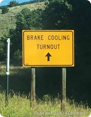
On Saturday (July 25) we spent the day exploring the Sinkhole Canyon area north of Lander, WY.  The drive up the canyon is about 20 miles long and very steep but it has some fantastic views.  There were several campgrounds along the road but nothing that would accommodate anything larger than a van or pickup camper.  On Sunday, we left Lander and headed to the Bighorn National Forest west of Sheridan, WY.  Highway 14 was billed as a very scenic drive but also as a very treacherous drive with extreme grades.  They were right on both accounts.  Shortly after entering the forest east of Worland, WY we started uphill.  The uphill grade continued for about 20 miles with very few breaks.  The scenery was outstanding with several water falls and amazing rock formations.  We found a nice campground near the top at 9050 ft - called Porcupine Campground.  On Monday morning we started the long downhill grade.  Warning signs at the top said the grade was 10% and continued for 15 miles.  They weren’t exaggerating one bit….  We spent the whole 15 miles in first gear and still had to do heavy braking.  Note to fellow RV’ers… the trip is well worth it but know the limits of your rig!  We have pulled our trailer many 10’s of thousands of miles around the west and this was the most extreme 15 miles we have every experienced!  The evening found us at Cooney State Park in Montana, which is north east of Yellowstone.  Next up is a drive over Sawtooth Mtn. Pass, which is advertised as one of the most scenic roads in America.

A beautiful day in Sinkhole CanyonDSC_8344

Water rushing down the hill into the sinkhole.  The water goes into the sinkhole and reemerges about a quarter mile laterDSC_8347

Into the Sinkhole….DSC_8348

Some views along Highway 14DSC_8364

DSC_8369

Yup, it’s going to be an interesting ride down

IMG_2472 IMG_2476

Route:

July 26 

image

July 27

image